

Architecture Engineering & Construction (AEC) is a resource-intensive industry. The advancements in science and technology, especially in the field of information technology enables services has contributed tremendously to the developments in the construction industry. With time, cost and quality resource planning being inevitably highly important determinants to the success of a project, the construction industry has spread open its arms to the adaptation of modern digital tools.
Geographical Information System (GIS) is an indispensable technology that has enabled the collection of large-scale geographical data from remote locations, its subsequent storage and management, performing of necessary analysis upon it to provide us with the desired output in the most user-friendly interface particularly with respect to space and time coordinates. Vehicular movement, geographical terrain- water bodies, plantations, settlements, rocks, mineral deposits, soil features, groundwater table, temperature, wind patterns are some of the data sets that are recorded by GIS along with their attribute sets like- intensity, frequency of occurrence, variations, density, colour, etc. It becomes pertinent for any project before it takes off, especially any construction project like- highway, factory, township, etc. to take these into consideration for maximizing the utility of deployed resources, avert wastage and minimizing the risks and hazards.

Building Information Modelling (BIM), is again a very dynamic technology that gives a real-time view of the project development during its complete lifecycle right from its inception to its completion and subsequently during facility management. You conceive a plan, plot it on AutoCAD, export it to over Revit, develop a 3-dimensional facility from the imported AutoCAD plan, assign material with requisite properties to structural and non-structural members, while, at the same time keeping a record of their quantities which automatically done by Revit by feeding it with necessary settings. The tool is amazing, now using NavisWorks Manage, you can perform simulation as per the work schedule prepared on primavera to come across any clash detection while the construction is being done virtually on screen. This encapsulates in brief about what BIM is all about.
It is quite understandable, from above that both GIS and BIM are not merely a software, but a technology that is being enhanced by a multitude of software in combination with each via interoperability. Thus, if both GIS and BIM are synced and utilized for execution of any project, imagine the benefits, humungous benefits can be accrued. This combination of GIS and BIM has been referred to as GEOBIM.

GeoBIM holds promising potential in the most uncertain and risk-prone industry of construction and engineering. To start any new project, we need a near-perfect site as the ideally perfect site is ideally quite tough to discover. Site selection entails study of many financial, commercial, social, technical and geographical features such as- groundwater table, water bodies, geotechnical profile, climatic conditions, terrain of the site and adjoining areas, habitation pattern, etc. Upon, Data pertaining to geography can be accessed remotely, to plan and confirm the site visit for certain locations out of the given list of probable sites. Moreover, if it is a highway project, GeoBIM can work wonders by giving a fair idea about the settlement patterns, vehicular movements with respect to time. The same can be utilized to decide the size of the project- length and width of the highway or elevated corridors and also the ideal and peak time of executing the project, which can be fed on to the BIM planning software to ensure smooth execution.
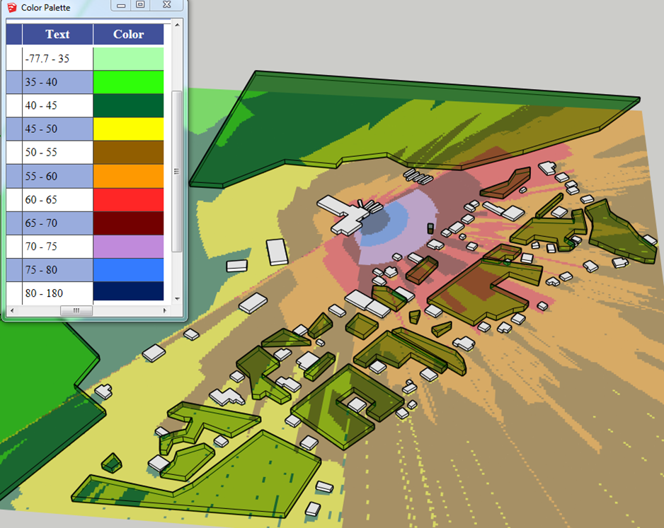
The same is true, we get to understand the topography, the climatic variants, wind flow direction, sun intensity so that we can decide the plan and elevation along with the materials, while designing and planning a passive facility in congruence with the local climate. We know, where the wind load will be severe, from where and at what time we will receive the maximum and minimum sunlight, seismic wave patterns, etc. Consequently, millions can be saved by avoiding- AC’s, heaters, sunshades, partitions and many more.
For industries we essentially require water and electricity, GIS can help even during the operation phase along with the facility management ( which is supported via BIM) about fluctuations water table and temperature of water bodies to curtail ecological imbalances.
Software developers are working meticulously on the interoperability of the file formats on various software to link both GIS and BIM. For instance, ArcGIS of GIS and IFC of Revit are being worked upon so that data obtained through GIS platforms can be easily and efficiently exported into the building modelling. Doing so, will save many unnecessary site visits, accurate forecasts and disaster mitigation, apt selection of material and accurate simulation of the project along its lifecycle. The project can be better managed and proficiently executed keeping all the stakeholders well communicated and at par with each other under any circumstances.


Well explained Nilay! This awareness is a must when BIM and GIS integration is being used from micro to macro levels of planning and construction.
Thank you Ayush